MTC SURVEYS was established in October 1992 and approved on 14th February 1993 by the General Survey Section, Urban Planning & Developing Authority (Professional Engineering Committee), as a Registered land Survey Company. As of December 2010, MTC SURVEYS has increased staffing levels to 105 personnel, comprising 45 field survey teams and office technical support. We are constantly improving our resources. Although all technical staff are recruited from overseas (from U.K, Italy, Romania, Philippines, Sri Lanka, India, Pakistan and Sudan); discerning clients appreciate that by commissioning survey work to MTC SURVEYS – they ( our clients ) are not only receiving the very best professional advice and expertise available they are also supporting local industry.
Cadastral & Farm Surveys
Boundary definitions for rural, residential and commercial properties are the traditional occupation of any professional land surveying company. Our Cadastral Survey Unit undertakes numerous boundary surveys each year for new lands, re-demarcation of existing properties, amalgamation surveys, registration, total acquisition surveys and farm surveys.
Control Surveys
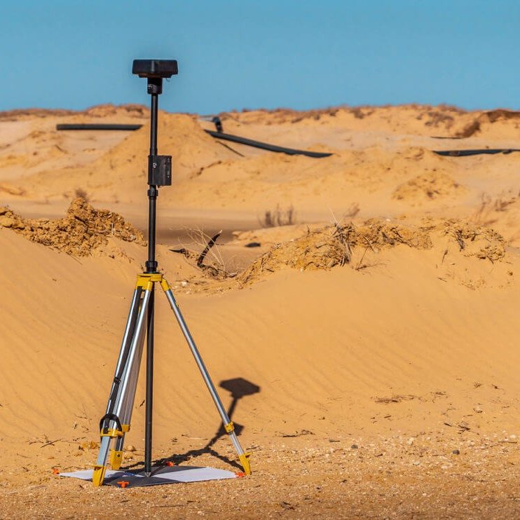
The basis of all surveys is entirely dependent upon the accuracy of the survey control – whether it be existing Government Survey Control Stations or new survey control. MTC SURVEYS has developed an excellent reputation for carrying out such surveys- typically on behalf of contracting companies at the early stage of their projects; using traditional survey techniques and GPS technology.
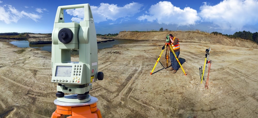
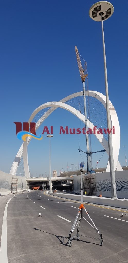
Topographic Surveys
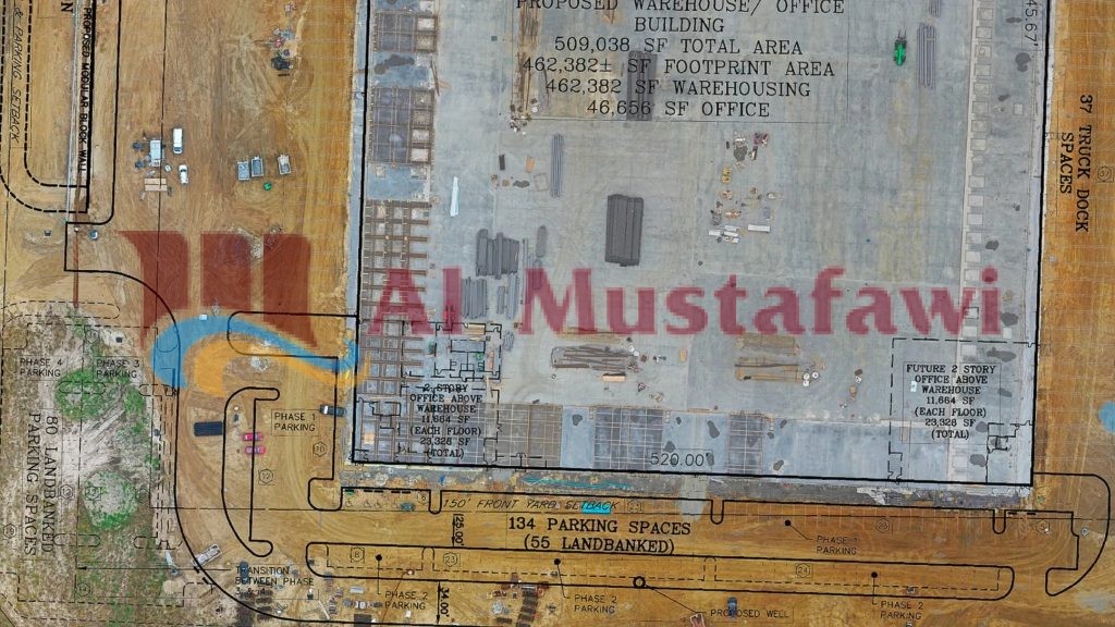
The State of Qatar is witnessing an incredible amount of development in all sectors – residential & commercial projects, expansive new education institutions, new highways, infrastructure & other public work, as well as in the oil & gas sector. Almost without exception, every project requires large-scale topographical surveys for design purposes, and for this very reason land survey companies are at the forefront of every new development, whether they be for major projects or modest sites for residential & commercial buildings. As a supplementary activity, MTC SURVEYS have the computing facilities and experience to calculate earthwork volumes. MTC SURVEYS has been involved in numerous prestigious projects, and over recent years provided detailed topographical surveys for Hamad Medical City ( including the Doha Asian Games Village ), Education City, the Doha Expressway, Qatar Primary Routes ( Salwa, Dukhan & Shamal Highways), the new Doha International Airport, Pearl, GTL, The Pearl Barwa – just to name a few. In the oil & gas sector, MTC SURVEYS have carried out detailed topographical surveys for Q-Chem, the Dukhan Gas Lift Projects, QatarGas II & QatarGas III, Qatar Shell, Dukhan Support Services Area, and more recently for the new Weat Extension to Ras Laffan Industrial City.
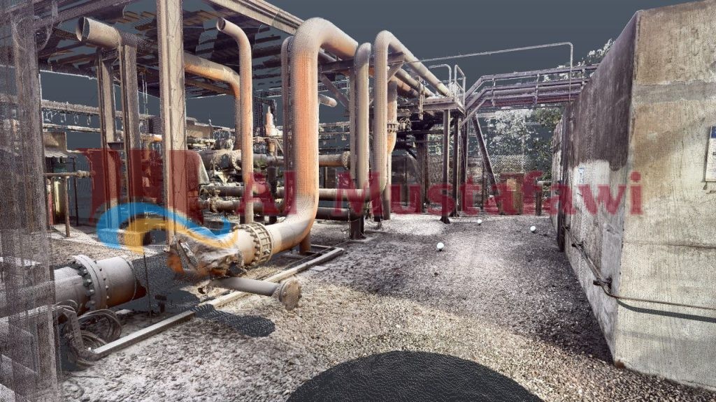
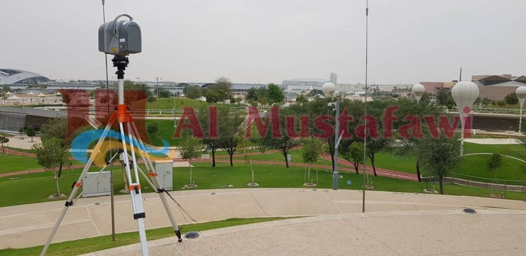
LIDAR Survey
We offer high-quality and precision topographical surveys in all fields of work using terrestrial LIDAR technology. With The FARO Focus3D laser scanner, we can provide detailed measurements with a density of up to 976,000 points/sec in a very short time and with a great distance of accuracy up to ± 2mm. It is the smallest 3D laser scanner ever built weighing just 5 kg and it has an intuitive touch screen display: Control all scanner functions with an easy-to-use touch interface. We are using the most efficient method for 3D measurement and 3D image documentation. In only a few minutes, this 3D laser scanner produces dense 360° point clouds containing millions of points that provide incredibly detailed 3D colour images of large-scale geometries using an integrated photorealistic 3D colour camera with a resolution up to 70 megapixels and a parallax-free colour overlay. Multiple scans from different positions using spheres or flat targets can then be automatically placed together with SCENE software to create a cohesive point cloud, resembling an exact measurable copy of even the most complex and large structures processed in Kubit and AutoCAD Civil 3D software. Based on this accurate data we provide detailed topographical plans, as-built surveys, traverse and longitudinal profiles, volume calculations, recreation of 3D objects like buildings, etc.
As-Built Surveys
(GIS records)
At the completion of civil projects the contracting companies are required to obtain the service of a government-approved land survey company to undertake the final “as-built” surveys suitable for GIS purposes and final “sign-off”. MTC Surveys has considerable experience in providing such service to contractors involved in projects for the Drainage & Roads Departments (of the Public Works Authority), Kahra-Maa and ASHGAL.
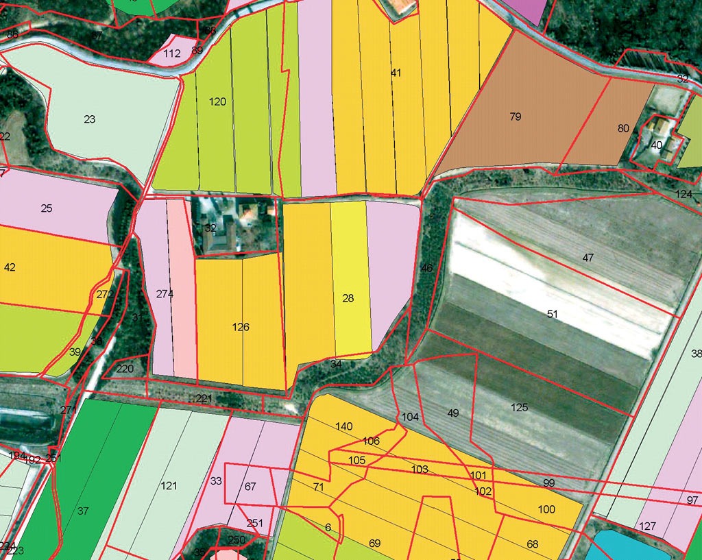
Geographic information system (GIS)
GIS plays the vital role of coordinating the nationwide. Implementation of these standards will facilitate Geographic Information System (GIS) data integration with the existing GIS data standards of ASHGHAL, KAHRAMMA and CGIS (Centre for GIS).
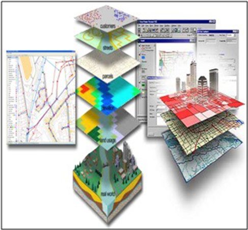
Our professional GIS team is skilled in converting Paper and digital information into meaningful and reliable GIS databases and data layers including:
• Geo-referencing.
• Data Interpolation and Integration CAD to GIS Conversion.
• Convert data to a different mapping coordinate system.
• Create polygons or areas from CAD line work.
- Decipher CAD layer codes and map all CAD layers to the corresponding GIS layers.
- Remove slivers and close artificial gaps in map features created by incomplete line work or symbol placement.
- Split lines where the attribute of the feature changes.
- Retrieve attributes from tables, spreadsheets, or databases and attach these to features.
- Transform feature symbology to match GIS requirements.

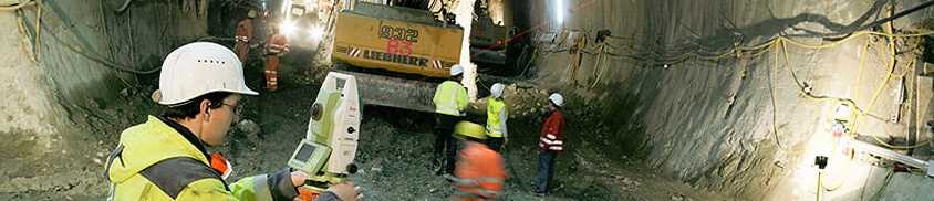
Tunneling & Monitoring Surveys
MTEC Tunneling and Monitoring Surveys is the latest established independent section aiming to provide broader services to the upcoming developmental project requirements. All of our recruited technical staff have years of experience in tunnelling and monitoring survey fields including highway, railway, MRT subway and underground sewage water pipe system tunnelling projects in far-east Asia. Our surveyor’s activity during different tunnelling projects includes support for the various survey control guiding systems, such as laser pot target, gyroscope baseline, and semi-automatic or fully automatic total station systems that provide precise survey reports for supporting construction analysis and judgments.

With our present manpower and equipment structure, we have full ability to plan and execute tunnelling survey-related activities such as site condition survey, initial monitoring survey, traverse and control monuments survey, tunnel excavation guiding survey, construction and cross-section survey, QC checking and real circle measuring and as-built surveys, as well as any other survey activities. We can offer complete turnkey solutions at all levels. In addition, we are working with the highly advanced monitoring survey team which has finished several major monitoring projects in Europe and the Middle East area. The team includes experienced technicians who are using advanced simulation programs to process and analyze huge monitoring data to provide correct warning reports. The use of high-end instruments and accessories renders efficiency in time and manpower making it cost effective for clients. We will deliver a powerful strength to easily provide full-function service and support to fit all project construction and design of surveying demands for our clients. From land survey to marine survey, site work to office work, instrument maintenance and calibration, MTEC Tunneling and Monitoring Surveys will fulfil the toughest requirements of the surveying work field in the State of Qatar.
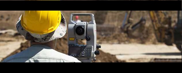
Engineering Surveys Team Hire
The majority of our Senior Engineering Surveyors have considerable experience in engineering surveys; and we are often approached (particularly by contracting companies) to assist in their project activities, whether as a lump-sum price or on a “Team Hire” basis.
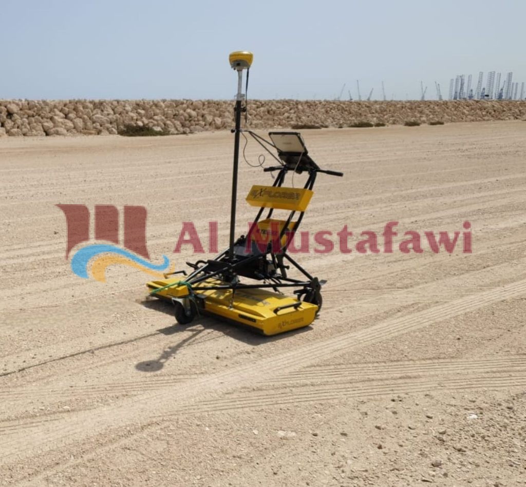
Underground Utility Surveys (GPR)
MTEC in JV with IMG of Italy is a specialized services division providing GPR, seismic, and geo-electrical surveys for very accurate underground services mapping and geological modelling and is noted for its continual development of specialised software and instrumentation. IMG has worked together with IDS Ingegneria dei Sistemi Spa – Italy, for the development of the new software for the data processing and mapping of underground services with GPR multiarray systems.